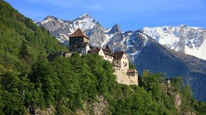
One Country. One Trail.
It is an experience not to be missed: discover the historical highlights of the Principality of Liechtenstein on foot on the Liechtenstein Trail. Where else can you walk an entire country in just a few days and learn all about its rich, 300-year history at the same time? Awaiting the explorer are 75 kilometres full of exciting stories, sights, majestic views, idyllic spots to have a rest, and much more.
Information & contact
There are many ways to explore the Liechtenstein Trail. Experienced hikers with good fitness can complete the entire route in one day, though most walkers will want to take a little more time. We recommend breaking the Liechtenstein Trail up into several stages or choosing a section of the route for an enjoyable day hike.
Day 1
Arrival (overnight stay optional)
Day 2
Balzers – Triesenberg
Distance: 14km / walking time: approx. 4 hours
Ascent/descent: 572 vertical metres / 184 vertical metres, min./max. altitude: 470m/901m
Day 3
Triesenberg – Vaduz
Distance: 10km / walking time: approx. 3 hours
Ascent/descent: 264 vertical metres / 692 vertical metres, min./max. altitude: 456m/1,109m
Day 4
Vaduz – Nendeln
Distance: 17km / walking time: approx. 5 hours
Ascent/descent: 571 vertical metres / 576 vertical metres, min./max. altitude: 450m/794m
Day 5
Nendeln – Ruggell
Distance: 15km / walking time: approx. 4 hours
Ascent/descent: 269 vertical metres / 289 vertical metres, min./max. altitude: 433m/541m
Day 6
Ruggell – Schaanwald
Distance: 19 km / walking time: approx. 5 hours 30 min.
Ascent/descent: 507 vertical metres / 479 vertical metres, min./max. altitude: 429m/683m
Additional tour
Malbun route
Distance: 7 km / walking time: approx. approx. 2 hours
Ascent/descent: 129 vertical metres / 520 vertical metres, min./max. altitude: 1600m/2000m
- Physical signage all along the trail
- The trail goes through all 11 municipalities of Liechtenstein
- The route is 75 kilometres long
- Ascents/descents of 2,000 m/2,000 m
- Min./max. altitude of 429 m/1,103 m
- Overall walking time of 21 hours
- The trail can go from south to north or north to south
- The route exclusively consists of the existing network of paths and trails
- It is possible to begin the trail from every municipality
- Parts of the route are also accessible for people with limited mobility
"LIstory" App
The free "LIstory" app accompanies hikers on the Liechtenstein Trail and allows Liechtenstein’s history to be experienced easily.
Accommodation
At the end of each stage you will find a range of accommodation and restaurants in or near the place where you stop for the night.
Liechtenstein Marketing
Äulestrasse 30
9490 Vaduz
Principality of Liechtenstein
info@liechtenstein.li
www.tourismus.li
Show in Google Maps


